Spokane County · Washington
Harvest Prairie Estates
Forty-three homesites across two surveyed tracts in Spokane County — 470.87 acres divided into lots of 9.8 to 19.8 acres. The Deno Road survey was recorded in May 2025 and the covenants in December 2025. Well and septic per lot.
On the ground
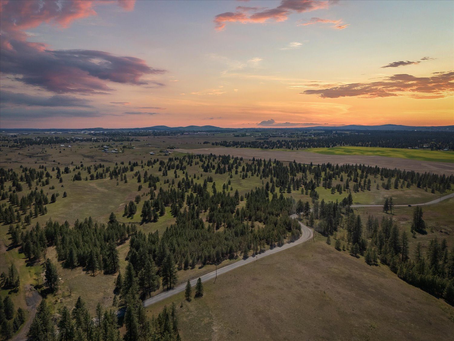
Aerial tour — filmed on the property
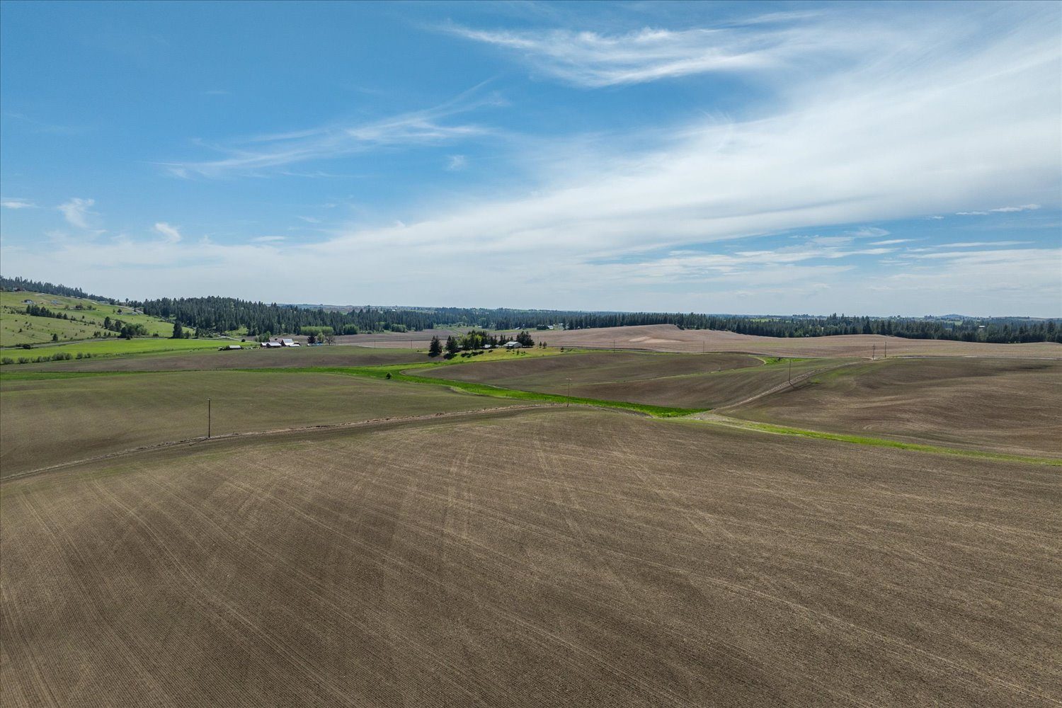
Both tracts from the air.
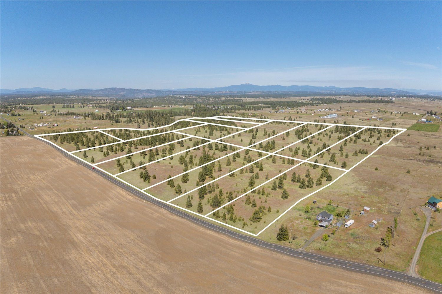
Unedited drone flights over the two tracts. Nothing in them is a rendering, and no home, road or improvement is shown that does not exist. Lot lines appear only on the site-plan aerial and on the surveys.
The property
Two tracts, surveyed and sold by the lot.
Harvest Prairie Estates is two separate tracts in Spokane County, each divided under a Spokane County certificate of exemption and sold as individual homesites. Together they run 470.87 acres and forty-three lots.
Deno Road is 156.38 acres in the northwest quarter of Section 15, Township 25 North, Range 41 East, divided into fifteen lots — fourteen of 10.04 acres and one of 15.82. It fronts Rambo Road on the north and Deno Road on the east. Lots 7 through 11 are reached over private drive easements recorded at A.F.N. 7411151 and 7411152 rather than off a public road.
Jackson Road, near Mica, is 314.49 acres in Section 13, Township 24 North, Range 44 East, divided into twenty-eight lots lying between South Jackson Road on the west and South Linke Road on the east. Twenty-four run 9.82 to 10.67 acres; four — lots 6, 7, 19 and 25 — run 18.57 to 19.79 acres.
Every lot is served by its own well and its own on-site septic. There is no public water and no public sewer at either tract. Interior access at Deno Road is by private drive easement, maintained by the owners it serves, not by Spokane County.
Covenants were recorded on 17 December 2025. They permit site-built homes, barndominiums and manufactured homes five years old or newer, set a 1,400 square foot minimum, and bar any further division of a lot. They are recorded against the fifteen Deno Road lots only. No covenants for the Jackson Road tract appear in the file.
The Jackson Road survey has not been recorded yet. Both copies in the file carry the surveyor’s preliminary stamp and a blank auditor’s certificate. Acreages here are taken from the later of the two sheets, dated 1 April 2026, and they differ from the earlier sheet on sixteen lots. Confirm the recorded version before closing.
Recorded facts
The surveys
Choose a lot.
These are the two survey sheets themselves, placed side by side at a common scale. Select a numbered marker for acreage, price and status, or jump to either tract and zoom in. Lot numbers restart at 1 on each tract, exactly as they do on the surveys.
Deno Road, Bk 207 of Surveys Pg 97 · Jackson Road, Job 25-28 sheets 1–2, preliminary · Gordon Land Surveying · Both at 1 in = 200 ft · Drag to pan, scroll to zoom
The same lots, from the air
Availability
Lot schedule
Acreages are as shown on the surveys — the recorded survey at Deno Road, the 1 April 2026 sheet at Jackson Road. Select a row to locate that lot on the map above.
| Lot▾ | Acres▾ | Tract▾ | Notes | Price▾ | Per acre▾ | Status▾ |
|---|
List prices are as published in the lot price schedule of 24 January 2026. Where the 1 April 2026 Jackson Road survey changed an acreage, the list price was left as published and the per-acre figure recalculated; prices have not been re-struck against the new acreages.
Water
The question every buyer asks first.
Neither tract has public water. Every lot is on its own well. At Jackson Road that risk was studied. At Deno Road it has not been, and this page says so rather than letting a buyer assume otherwise.
Budinger & Associates reviewed eighty-three Washington Department of Ecology well reports around the Jackson Road parcel in April 2025. Reported flow rates ran from 1 to 150 gallons per minute, and the rate reported most often was 5 gpm. Setting aside a handful of unusually strong wells — two at 150 gpm, three at 60, five between 30 and 50 — the rest averaged 6.5 gpm, with an average static water level of 115 feet and an average depth of 513 feet.
Washington requires a minimum of 1,440 gallons per day, a continuous 1 gpm, before a building permit will issue on a well. In all but one of the eighty-three reports the yield at time of drilling met that. Budinger concluded that it should be possible to drill a well on each lot in the subdivision with sufficient yield for permitting and development, and said in the same paragraph that drilling may require more than one attempt.
The report is candid about its own limits, and they are worth reading before relying on it. It is a preliminary evaluation built on existing well logs, not on test drilling on the property. The reported yields were not independently verified. Budinger recommends monitoring water levels and production as new wells go in, and aquifer testing on the first few, and notes that continued development in the area may cause water levels and production rates to fall over time as production outruns recharge.
Detail
No study at Deno Road. The groundwater work covers the Jackson Road parcel only. A buyer relying on water availability at Deno Road should commission their own.
Check the cover page. The study was commissioned by Terra Land Investments, Inc. and names Brett and Brian, LLC as the then owner. It predates the current ownership, and the parcel number on its cover is the parent parcel the Jackson Road lots were created from, not an individual lot.
One well is in. A well was drilled on Jackson Road lot 19 before that lot closed. Every other buyer drills their own.
Environmental and radon. ALLWEST’s Phase I ESA of 9 June 2025 identified no recognised environmental conditions at Jackson Road and concluded further assessment was not warranted, with one de minimis note: the full contents of the debris in the tree grove were not observed, and caution is advised when clearing there. Spokane County is an EPA Radon Zone 1 area, the highest classification, and radon-resistant construction should be considered on any lot.
Covenants
What you can build
Drawn from the Declaration of Covenants, Conditions and Restrictions recorded 17 December 2025 at A.F.N. 7459724. The recorded document governs; this is a summary. It binds the fifteen Deno Road lots. The Jackson Road tract has no recorded covenants in the file.
Residential and agricultural
Each tract is for residential and agricultural use. Small home-based businesses are allowed if they create no traffic, noise or nuisance. No commercial or industrial use.
Three kinds allowed
Single-family site-built homes, barndominiums, and manufactured homes five years old or newer at the time of placement.
1,400 sq ft minimum
Exclusive of porches, garages and patios.
Permanent foundation
HUD construction and safety standards, Washington installation codes, permanent foundation and skirting. Roofing and siding must read as residential.
Metal or wood frame
Permanently constructed with finished siding, compatible with the rural character of the development.
No further subdivision
No tract may be divided into parcels smaller than the lots shown on the recorded plat.
One guest house or ADU
Permitted if it meets county regulations. No RV, tent, shack, trailer, barn, garage or outbuilding may be used as a permanent residence.
18 months, permit-tied
An RV may be lived in only while a valid Spokane County building permit is open, for no more than eighteen months from issuance, then disconnected and removed.
Horses, cattle, goats, poultry
For personal use, properly fenced and maintained, consistent with Spokane County regulations. No commercial feedlots, kennels or breeding operations.
Rural character
Wood, barbed wire, wire mesh or vinyl. Chain link only in limited areas such as gardens or dog runs. No solid metal or junk fencing.
Underground where feasible
Easements shown on the recorded plat stay unobstructed. No permanent structure may be erected within an easement.
30 years, then renewing
Runs with the land for thirty years from recording, renewing in ten-year periods unless amended by a recorded majority of 51% of owners. Enforceable by the declarant or any owner.
Diligence file
Everything we relied on.
The documents behind every figure on this page, including the ones that complicate it. One short form unlocks all of them.
Location
Two sides of Spokane.
The tracts sit on opposite sides of the Spokane metro, about twenty-one miles apart measured section centre to section centre on the public-land survey grid. Jackson Road is near Mica, about a mile east of State Route 27 and half a mile north of East Belmont Road, in rolling Palouse farmland with about 350 feet of relief sloping south toward California Creek. Deno Road lies west of the city, fronting Rambo Road on the north and Deno Road on the east.
Legal location
Section, township and range are from the recorded surveys. The Jackson Road locators and the relief figure are quoted from the Budinger & Associates water supply study of 24 April 2025. Neither survey prints a coordinate, so none is published here. The twenty-one mile figure is computed from the two legal descriptions on the survey grid, where a township and a range each measure six miles. Drive times are omitted — no source document states them. Ask and we will send measured routes.
Site location
Sec 13
T24N R44E
Jackson Road tract, between S Jackson
and S Linke Roads · Mica, Washington
Road-name searches, not surveyed locations.
Inquiries
Three ways to buy here.
Lots sell individually, in groups to builders on one contract, and through co-operating brokers. Every enquiry reaches a person. Call Justin at (281) 660-1133 or Ben at (469) 371-5106.
Brokers & realtors
Co-op program
Co-op split of 3% on every closed lot. Client registration and protection terms are in the agreement.
Request co-op termsHomebuilders
Multi-lot takedown
Package pricing, phased takedown schedules, and the full survey, covenant and groundwater file for both tracts.
Request the builder packageIndividual buyers
Single homesite
Reserve a lot, read the recorded covenants, and walk the ground with a representative.
Ask about a lot